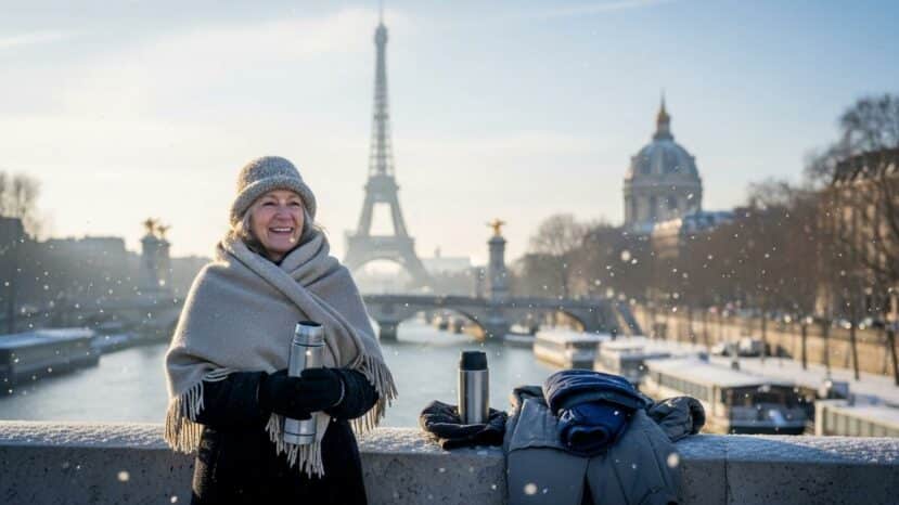
Snow in Paris for Christmas: polar cold and snowfall expected in the Île-de-France region

Paris prepares for a winter turn, just before Christmas. Snow could make a furtive appearance, in an air coming from the north. However, nothing is decided yet.
According to the modelsÎle-de-France will experience a marked cooling. So everyone is already thinking about the impact of the cold. However, scenarios still differ as to intensity and duration.
Polar cold approaching: what do the forecasts say?
The latest forecasts from Météo-France point to a descent of icy air towards the region. In addition, light precipitation, sometimes in the form of flakes, could lead to snow locally. The timing is in the holiday season, and reliability is still limited.
Uncertainty about intensity and accumulation remains high. On the other hand, it is likely to feel biting, with a northeasterly wind. Mornings will be prickly, especially away from urban areas.
“The risk exists, but the intensity will depend on the trajectories.”
Fog, ice and wind: risks to watch out for
Black ice is a major hazard on sidewalks and slopes. A fine dusting of snow can be surprising in the early hours. Shaded areas and bridges freeze over more quickly.
Roads exposed to the wind freeze over more quickly, especially at dawn. So pedestrians and cyclists need to adapt their routes and speeds. So be extra careful near subway entrances and exits.
- Check sidewalks before going out.
- Leave 10 minutes earlier to reduce stress.
- Layer three light, breathable layers.
- Bring water, hat, gloves and headlamp.
- In an emergency, call 112, 15 or 18.
Transport and the city: how to get organized without stress
Transport operators adjust their services when the road surface turns white. So, in the event of snow, some bus routes may be limited. Remain flexible, and take the metro if possible.
Anticipate your journeys and keep a realistic plan B. What’s more, airports de-ice planes, which can sometimes cause delays. In addition, road traffic requires distance and flexible driving.
The road department launches salt-spreading campaigns on sensitive roads. In addition, street outreach workers are on duty to help the homeless. The extreme-cold plan may be activated depending on the mercury.
Schools adapt outdoor activities according to the status of classes. As a result, parents and staff keep in touch quickly via messages. Remember to pack an extra warm layer in your schoolbag.
Home and health: prevention without dramatization
Ventilate for ten minutes a day, even if the house seems cold. This will limit dampness and mold after the snow. Watch out for auxiliary heaters, which can be a source of monoxide poisoning.
Set living rooms to around 19°C, then adjust according to age. Also, protect exposed pipes and keep an eye on fragile pets. Keep your medicines and prescriptions close at hand.
What the models say… and what you can do now
Models become more reliable as the event approaches. The most reliable window is 48 to 72 hours before the event. The probability of snow then changes significantly, either upwards or downwards.
Follow official bulletins and look out for warning signs. Also, compare several sources to avoid the rumor effect. In short, rely on updates rather than a fixed map.
Prepare a small winter kit for your daily travels. And keep a waterproof bag with dry clothes and a charger. You’ll be ready when the snow finally arrives.


Aucun commentaire
Publier un commentaire
Participez toujours dans le respect de la loi et des personnes.